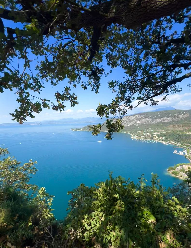
Fill your eyes with blue on this hike leading to a unique and breathtaking panoramic viewpoint.
A short but adventure-filled route combining nature, stunning views and the tranquillity of the woods:
- a breathtaking view of Lake Garda;
- a mostly shaded route, ideal even on warmer days;
- a woodland trail with information boards about local biodiversity;
- a short distance, perfect for a walk of less than an hour, but easily extendable for those looking for a longer adventure. 🐾
If you would like to extend your hike through the woods, there are several other trails to explore, including routes that descend towards the town of Garda.
Route description
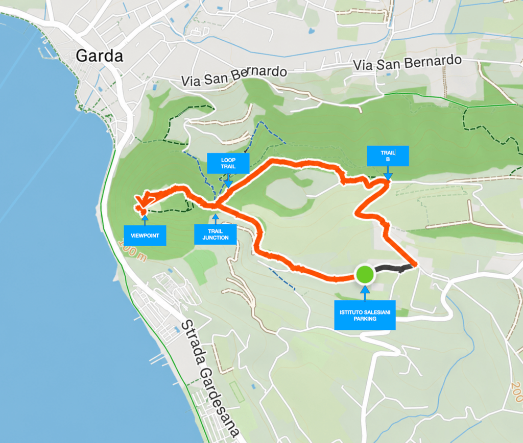
The route runs clockwise.
STARTING POINT
The starting point is at Via Strada di Sem, 1, at the Istituto Salesiano Tusini in Bardolino.
Here you can park your car in the parking area near the recycling collection point.
Start your walk with the Institute on your left, following the paved road that passes in front of Agriturismo La Rocca and Relais Casaliva.
TOWARDS LA ROCCA
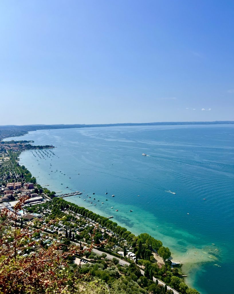
The first section is paved, but you can immediately catch your first glimpse of Lake Garda on your left.
What you see along the shoreline is Bardolino: a beautiful welcome to this hike towards La Rocca!
After about 360 metres, you will find a road on your right marked “Percorso La Rocca”.
Take this road and, after a very short uphill section, you will reach a dirt trail.
Continue for another 600 metres and enjoy the view of La Rocca, which seems to cradle the deep blue of the lake.
👼👼👼 Did you notice the angels placed on a rock along this section? If you missed them, it is worth walking back about a hundred metres to look for them. They have been there for several years and, despite the weather and the elements, they continue to rest there, gazing out over this wonderful corner of nature.
TOWARDS THE PANORAMIC VIEWPOINT
At this point, you will reach a junction with several other trails, marked on the map as “TRAIL JUNCTION“.
👉 Take the trail on your left, the one that goes uphill.
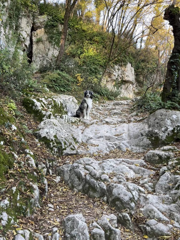
The surface changes and becomes rocky. Don’t worry: this section is about 250 metres long and climbs almost like a natural staircase.
It is a short change of terrain that will allow you to immerse yourself even more in the natural surroundings. Once you have completed the climb, continue along the final section of trail for about 150 metres.
And now you can finally say “WOW” and enjoy the view in front of you.
Take a few minutes to admire it… and now it’s time to get your phone out for some beautiful selfies with your four-legged adventure companion. 🐾🐾
⚠️ KEEP YOUR DOG SAFE
Even if you are used to letting your dog off the leash and you are confident that they will never wander away, keep your dog on a leash at all times in this section.
The rocky terrain and, especially, the panoramic viewpoint have several steep drops overlooking the lake and the woods below.
🐾 Never let your dog off the leash in this area.
THE LOOP
If you’re not in a hurry to head back and have some free time to enjoy, this is definitely one of those places where you can relax and let your eyes wander across the blue between the sky and the lake.
When you’re ready to leave, walk back along the rocky trail you came from and return to the “TRAIL JUNCTION“.
Here you will find three options:
↩️ straight ahead: the trail you came from;
🔄 slightly to the left: the route to complete the LOOP TRAIL;
⬅️ further to the left: a third trail leading down towards the town of Garda.
👉 To complete the loop, take the trail slightly to the left of the one you came from. It is marked on the map as “LOOP TRAIL”.
The trail climbs until you reach a white dirt road from which you can reach the Eremo di San Giorgio. To continue the loop, instead follow the white road downhill.
After the second hairpin bend, you will find a trail on your right leading back into the woods.
It is marked by a brown sign with the letter B.
👉 Take this trail and continue for about 300 metres. At the end of the wooded section, you will reach a paved road again.
Follow the road and, at the next junction, about 200 metres further on, you will reach Strada di Sem again. Turn right and after about 400 metres you will be back at your car.
What to wear and bring:
🥾 Hiking shoes
🦟 Mosquito repellent in summer
🧢 Sun hat in summer
📱 A charged phone for photos
Have you got everything your adventure buddy needs? 🐶
💧 A bottle of fresh water.
🦮 A good leash. Safety first!
🍪 Some treats. I’m sure your dog will appreciate. 😋

💡 A little tip and safety reminder:
Why is part of the route shown in black on the map?
When you use apps to record and share your hikes or sports activities, some of them allow you to hide the starting and ending sections of your route.
This is a very useful feature for protecting your privacy and safety. For example, if you usually start your walks from home or from the same location, hiding this section prevents others from identifying your exact starting point.
For our route, we have therefore chosen to hide the first section, specifically to show how this simple feature can be used to share your adventures without revealing personal information.
🐾 Share your route, yes. Share your home and your habits… better not!